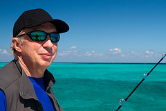
This is part 1 of Richard Bang’s 4-part travelogue
Over the years I’ve caressed many of the Caribbean gems, but never a set like the Cayman Islands. An accident of geography and geology, the three coral islands, cursed with terrible soil, minimal terrestrial relief, no rivers or lakes, but a bask of crocodiles, was not settled by the Caribs, Arawaks, Tainos, or any other autochthons, by the time Christopher Columbus sailed by in 1503. The sharp, black dolomite outcroppings in some places evoked Hades rather than any sort of haven. The first recorded English visitor was Sir Francis Drake in 1586, who reported that the crocs, or caymanas, were edible, as well as the many turtles, but that note didn’t persuade immigration until around 1700, when the first recorded permanent inhabitant of the Cayman Islands, Isaac Bodden, of Welsh descent, was born on Grand Cayman. After him came pirates, refugees from the Spanish Inquisition, shipwrecked sailors, and slaves, but not many as the barren land couldn’t really support plantations or communities of consequence, as nearby Jamaica and Cuba could. So, it grew up a place with few people. Instead the world came to Cayman, into its coves, sounds, channels, runs and bays. And that diversity of settlers may have saved it from the worn-out, overtaxed fate other islands have suffered. It became a place where everyone was from somewhere else—over 100 different nationalities are represented today— and that ripened into an ethos that invites strangers into the conversation.
Aerial of Cayman Islands. Photo: Didrik Johnck
The Caymans Islands float at a magical inflection point influenced by three continents, and a radiance of nearby islands. Buccaneers prowled about in search of provisions, safe harbors, and remote spots to bury doubloons. The anchored ships were in a way like bees pollinating flowers in gardens far from where they started, spreading ideas, arts and cultures over this trinity of islands. They brought different music, dance, foods, customs, crafts, beliefs, and new human constructs….the travelers and adventures found shelter and social interaction, and the seeds of multiculturalism were sown. I take the Bird of Paradise, Cayman Airways, from Miami, a Boeing 737-300, and am delighted to find the carrier allows two free checked bags, the exception these days. It is also the only carrier I’ve ever flown that offers rum punch on the service tray. Turns out the punch is supplied by the Tortuga Rum Cake factory, started by a former pilot, Robert Hamaty, whose son, Basil, is our captain. As we pull to the gate at Owen Roberts Airport there is a giant green iguana on the tarmac. No ordinary airport, this. No ordinary airline. There have been dozens of airlines in the Caribbean that launched and then fell into the ocean of bankruptcies. But Cayman Airways has been around since 1968, and now serves half a dozen cities in the U.S., as well as Cuba, Jamaica, Panama and Honduras.
On the taxi ride to the Westin Casuarina, the driver, almost to the point of overprize, crows about how safe Cayman is…. “You can walk anywhere, anytime, mon. The beaches have no litter, no vendors, no hassles, no homeless, just pure sugar sand.” I live in Venice Beach, near the Google offices, and despite the home prices and wealth, there is a large indigent population, and a crime rate not to be envied. How do they do it here? In 1966 legislation passed enabling the banking industry in the Cayman Islands, and that changed everything. The British Overseas Territory went from a sleepy backwater with scarce resources to the fifth-largest banking center in the world with trillions on deposit. Today it has branches of 40 of the world’s 50 largest banks. One five-story building in the capital George Town, The Ugland House, no bigger than a boutique hotel, houses over 18,000 corporations. Business and financial services contribute 30% of the GDP, and employ more than 20% of the labor force. The Cayman Islands has the highest per capital income in the Caribbean, no taxes, and almost no unemployment. And it has evolved into a matchlessly clean, pristine and pleasing destination for travelers.
A couple strolling along 7-Mile Beach. Photo: Didrik Johnck
At the northern end of Seven-Mile Beach (it clocks in at five miles and a few minutes long, but that’s the nature of Cayman….everything is a little bigger than reality), I check into the hotel and take a room where I can see the powdery sweep of sand, the tufted tops of palms soughing in the breeze, and the tourmaline waters that will somewhere to the west brush the shores of Central America. The tumbling sun bathes the remnants of the day in gold, the norm here I’m told, and radiates romance. Barefoot couples stroll the seam between sand and water, hand-in-hand, while others sip champagne on lounge chairs as the tropic air seduces. By the reckonings of a number of sand experts, this is the most romantic beach in the Caribbean. It’s as close to living brochureware, or a set for a diamond commercial, as I’ve seen in real life. Later I chat with Joanne Brown, CEO & Creative Director of a company called Celebrations, a wedding planning company, and she says business is booming. Many folks come here, she says, and are bewitched by the beaches, the diving, the sunsets, the food and wine, and decide to return to tie the knot. Shuttles of birdsong nudge me awake the morning next. After a tropical fruit breakfast I drive east to Queen Elizabeth II Botanic Park to see first-hand one of the most remarkable species comeback stories in modern history: the back-from-the-brink saga of the blue iguana. Just a decade ago, the Grand Cayman blue iguana teetered on the cliff of oblivion, with only 10 to 25 left in the wild, all on this one island. Unaccustomed to predation, it fell victim to an invasion of stray dogs, feral cats and rats. Many ended up as road kill as they sunbathed on increasingly busy streets. But as of my visit the turquoise-colored reptile has returned to promising numbers, and is no longer listed as a critically endangered species. It dodged the bullet of extinction. With a switchblade strut that telegraphs sense of purpose, John Marotta, head warden of the Blue Iguana Recovery Program, shows me around the captive breeding facility. He says the blue iguana now has a population of about 750, and is on the path to achieving the goal of restoring 1,000 blue iguanas to Grand Cayman’s shrub lands. “If I’m successful, I’ll work myself out of a job,” John volunteers. “And I’m happy with that.”
Blue Iguana. Photo: Didrik Johnck
The blue iguana is the largest native species on Grand Cayman, up to five feet in length and weighing in at more than 25 pounds (the native crocodiles were bigger, but they are all gone.) The Blue Iguana once ranged over most of the island’s coastal areas and interior dry lands, but without anyone paying attention, they almost vanished. Blue Iguanas are beautiful, with a pimpy fashion sense, but they also have that red-eyed Godzilla look that evokes menace, and they are in fact dangerous. John has 37 stitches from various bites over the seven years he’s worked to help the coldblooded critters, as well as a dislocated thumb. But one friendly fella, Methuselah, 27-years-young, lets John hold and pet him, and even allows me to rub his spikes and scratch the back of his head. John says the charismatic nature of the blue iguanas has helped raise the monies needed to bring them back, but also has helped habitat protection, as the unglamorous scrubland that few value, but which is important from an ecological standpoint, is now being set aside and protected. John explains the program helps give juvenile iguanas a head start by protecting them for their first two vulnerable years of life, when they are still small enough to be easy snack food. Then, with radio monitors attached, they are released into the wild. After an hour of barely containing his feral enthusiasm for saving the blue iguanas, John excuses himself, as a school group is approaching, and he wants to direct energies to them. A dozen years ago I did a stint as president of Outward Bound, and one initiative under my watch was “expeditionary learning,” in which students participate in outdoor, hands-on education, rather than from books or lectures. “This is the way to get them involved in life-long conservation,” John echoes, and bolts off to his outdoor classroom, where the future is being written with lightning.
(Note: this piece does not explore or comment upon any political or ideological aspects of North Korea, nor does it pass any judgments or make critiques…there are many books and articles that do that…but rather this is merely an account of travel through a remarkable and little-known land as a guest of the state.)
It’s been almost 60 years since the end of the Korean War, and for most of that time Americans had been prohibited from visiting North Korea by its government. For many years I canvassed any contact I could ferret about securing visitation, but for naught. Until this year. I rendezvous with 23 friends in Beijing, and the first indication that we are entering a Twilight Zone is when a plastic bag is circulated at the airport before boarding the Air Koryo flight…in it we deposit our cell phones, and any books about our destination, as they are not allowed in the DPRK. We are, however, permitted to bring cameras (with lenses less than 200 mms), laptops, Kindles and iPads, as long as they don’t have activated GPS. There is, of course, no public internet access in-country.
North Korea’s Arch of Triumph is larger than the one in Paris. Photo: Stephan X (cc)
On board the Russian-built Tupolev Tu-204 instead of Muzak we are soothed by the national anthem, the newspaper distributed is the Pyongyang Times (in English), and on the video monitors are dramatic recreations of World War II, as well as a tourist video that evokes Disney documentaries from the 1950s. Immigration and customs are easy, faster than most first-world airports, and they do not stamp our passports, so you just have to take my word that we were there. We’re greeted by guides Mr. Lee and Miss Lee (no relation), who usher us onto a Chinese made luxury bus called King Long, where we roll down spotless extra-wide streets by willow trees and tall apartment buildings, past heroic posters and photos of Kim Il-sung, the country’s founding leader, and his son Kim Jong-il, who died in December 2011, leaving his third son, 29-year-old Kim Jong-un in charge. We drive through the Arch of Triumph (larger than the Paris version), and into downtown Pyongyang, the capital. Along the way Mr. Lee, shares, in enunciation occasionally untidy, some information…the country has 24 million people; 3 million in the capital. It is 80% covered by mountains. From 1905-1945 it was brutally occupied by the Japanese. The Korean War (known as the Fatherland Liberation War by the DPRK) lasted from 1950-53, and during that time there were 400,000 people in Pyongyang, and the Americans dropped 400,000 bombs on the city. We cross a bridge to an island in the Taedong River, and pull up to the 47-story Yanggakdo International Hotel, with 1000 rooms, a revolving restaurant on top, a lobby bar with Taedonggang, a very good beer, and room television with five channels of North Korean programming, and one featuring the BBC.
As the day bleeds to night we head to the Rŭngrado May First Stadium, largest in the world by capacity. We park by a Niagara-sized dancing colored fountain to which Steve Wynn could only aspire, walk past a line of Mercedes, BMWs, and Hummers, up the steps to prime seats (where Madeleine Albright once sat) at the Arirang Mass Games. The Games (there is no competition, just spectacle) are a jaw-dropping 90-minute gymnastic extravaganza, with meticulously choreographed dancers, acrobats, trapeze artists, giant puppets, and huge mosaic pictures created by more than 30,000 sharply disciplined school children holding up colored cards, as though in bleachers at the world’s biggest football game. The London Guardian calls the Mass Games “the greatest, strangest, most awe-inspiring political spectacle on earth.” The Guinness Book says there is nothing like it on earth. One hundred thousand performers in every candy color of the spectrum cavort, whirl, leap and caper in perfectly choreographed unison. A thousand Cirque du Soleils. Ten thousand Busby Berkeleys. It all makes the opening ceremonies of the Beijing Olympics look like the opening of the London Olympics.
Mt. Paektu
Finally, we pour from the stadium, past the vendors selling posters, DVDs and memorabilia, exhausted and in overstimulated wonderment. Early the morning next we head back to the airport, during the world’s quietest rush hour. One estimate is there are fewer than 30,000 vehicles in the whole of the country. We pass seven cars, several hundred single-gear bicycles, and perhaps a thousand pedestrians walking the edges of the streets. There are no fat people in this parade…all look fit, clean and healthy. There is no commercial air service to where we are headed (and no Lonely Planet Guide), so we have chartered an Antonov 24, during which the hostess wants to practice her English with us. Good thing, too, as I notice the sign at the Emergency Exit: “In case of stepped out of cabin, attract handle.” Ninety minutes later we land at Samjiyon, near the “sacred mountain of the revolution,” Mt. Paektu. At 8898 feet, it is Korea’s highest peak, and legend has it is where Korea’s first founder, the mythical Tangun, is said to have descended 5,000 years ago. The drive from the airstrip to the base of the mountain is an ecologist’s dream, pre-industrial, rice fields cultivated by hand, lush, green landscapes, clear streams, and unlogged forests of white birches. As we rise in elevation, the trees shrink into the soil, until we are in a moonscape, the flanks of the stirring volcano, Paektu (white topped mountain). This is the sublime hill, the most celebrated in North Korea, and we chevron to the summit in our Chinese bus. From the caldera rim we can look down to a beautiful blue crater lake, and across the lip…to Manchuria. There we see Chinese tourists waving back at us. This is also the spot where Kim Il-sung (Dear Leader) and his son Kim Jong-il (Great Leader) stood, with backs to the caldera, looking commandingly at the camera, offering up enlightenment and guidance. The image is recreated in vivid posters all over the country, so it is a delight to be here, like visiting the setting of an epic film.
There is a gondola that carries visitors down to Lake Chonji, Heaven Lake, alongside a steep stairway. It’s 5 Euro each for the ride, but I’m tempted by the exercise, and 40 minutes later meet the group by the frigid water. When Kim Jong-il died, it is said the ice on the lake cracked “so loud, it seemed to shake the Heavens and the Earth.” We take some photos, walk the verge of the lake, and then ready for the gondola ride back the rim. But the cables aren’t moving. The power has gone off, and nothing moves, even us. The prospect of climbing up is too grim for many in our group, including one woman who has shrapnel in her leg from a recent visit to Syria. So, as tempers and temperatures rise, and I consider what it would take to carry someone on my back, the power lurches back on, and the gondolas open their doors for the ride to heaven. The afternoon presents a personal surprise…we drive to The Secret Camp, where Kim Jong-il, our guides tell us, was born in Japanese-occupied Korea on February 16, 1942. His birth was foretold by a swallow, and heralded by the appearance of a double rainbow across the sky over the mountain, and a new star in the heavens. The simple log cabin (with roebuck deer hooves as door handles) of this auspicious birth stands near a stream called Sobek, spilling from its eponymous mountain. It turns out Sobek means “small mountain” (compared to Paektu). Sobek is the name of the adventure travel company I founded quite a few years ago, but it was christened after the crocodile god of the Nile, not a waterway named for a mini-me mountain. Nonetheless, our hosts are excited with the coincidence; I am honored just the same. We take the night at the cavernous Baegaebong Hotel, which could be the set for The Shinning, though we are the only guests. Nearby are the wide and scenic Rimyongsu Falls, spouting gemlike from a basaltic cliff, and there is a ski slope next door. But this is fall, so the assumption is we are off season, or tourism hasn’t lived up to expectations yet. The next day we visit the Revolutionary Regional Museum, fronted by ectype Siberian tigers, which still roam these mountains, and are traditional symbols of a unified Korea. Inside, the displays celebrate the North Korean victories over Japan and America, including a video of such shown on Toshiba monitor using Windows XP.
Windows XP and Toshiba set at the Revolutionary Regional Museum, photo by Richard Bangs
Then off to the Samjiyon Grand Monument, featuring a giant bronze statue of a young, stiff-backed Kim Il-sung in military regimentals, flanked by squads of oversized soldiers, back-dropped by Samji Lake, dotted like snowflakes with egrets. Revolutionary music plays from discreetly placed speakers. I am urged to buy a bouquet of flowers to lay at the base, and then we all line up, sans hats, and make a respectful bow. Photos are allowed, but only of the entire statue from the front, not parts or backsides. After lunch (the food is always hearty, plentiful, and includes meat of some sort, always kimchi, soup, rice, potatoes and beer, but never dog, which is a summer dish), we make a 40-minute charter flight to the Orang airport, not far from the border with Russia, landing next to a line of MiG-21s.
From there we drive three hours to Mount Chilbo, “Seven Treasures,” a national park, and applicant for UNESCO World Heritage status. Along the way we pass tobacco and corn fields, cabbage patches, trips of goats, and lines of oxcarts carrying goods somewhere. We first stop beneath a 200-year-old chestnut tree at the Kaesimsa Buddhist temple (“America bombed the churches and Buddhist temples,” Mr. Lee tells us, “but they missed this one.”). It was built in 826, and serves today as a repository for important Buddhist sculptures, paintings, and scriptures. The monk has us gather in the temple, below images of flying apsaras, where he taps a gourd and chants. He says he prays for our good health and happiness, and that we will contribute to the peace of the world. Then he suggests we contribute to the donation jar. It’s a short hike to Inner Chilbo, an astonishing vista of wind and water sculpted turrets, buttes, mesas, masts, cathedrals and temples, a stunning combination of Yosemite, Bryce and Zion National Parks. Mr. Lee, in a North Face jacket and Prospect running shoes, plucks some pine mushrooms off the path, and shares them with the group, saying these are delicacies in Japan, sometimes selling for $100 a stem. After a few short hikes, we bus into a box canyon, and check into the closest thing North Korea has to an eco-lodge, the Outer Chilbo Hotel.
Sea of Chilbo. Photo: Uri Tours
The accommodations are spartan (plastic buckets filled with washing water outside the doors), but the setting–high cliffs on three sides, wooded grounds, a clear singing creek– is something apropos to an Aman Resort, and may yet someday be. The day next we hike to the Sungson Pavilion, a high platform that affords 360 degree views of Outer Chilbo, grand vistas of the serrated mountains and sheer cliffs that encase the park. And then we unwind the mountain, and trundle to the Sea of Chilbo, a last sigh of igneous rock that pours into the East Sea of Korea (Sea of Japan on most Western maps). The coastal village through which we pass is dripping with squid, hanging like ornaments form rooftops, clothes lines, and every exposed surface. The permeating parfum is eau de cephalopod. Past the electronic fences (to keep potential invaders out), on a wide beach, a long white table cloth is spread, and we settle down to a picnic feast of fresh calamari, crab, yellow corvina, anchovies, seaweed, and beer, just before the rain sets in.
The dirt road to Chongjin is lined with magnolias (in the north of North Korea we experience almost no pavement), and a richness of no billboards or advertising of any sort. We pass hundreds of soldiers, part of a million man army, in olive drab striding the highway, tractors that look like Mater from the Cars movies, and smoke-billowing trucks, which have furnaces on the flatbeds where wood is fed for fuel. It’s evening as we wheel into the steel and shipbuilding town, generously lit with streaks of neon (Hong Kong without the brands). We stop at the Fisherman’s Club, which is playing a video of launching rockets and enthusiastically clapping crowds as we order up Lithuanian vodka and something called “Eternal Youth Liquor, “which has a viper curled up inside the bottle, like a great tequila worm. We stagger into the Chongjin Hotel, past a pair of Kenwood speakers playing a stringed version of “Age of Aquarius,” stumble up the stairs beneath a poster of “The Immortal Flower, Kimjongilia,” a hybrid red begonia designed to bloom every year on Kim Jong-il’s birthday, and into rooms where the bathtubs are considerately pre-filled with water to use to flush the non-flushing Toto toilets. Motivational marshal music cracks the day. We can’t leave the hotel compound (some power-walk the driveway for exercise, looking like guests at the Hanoi Hilton), but several of us gather at the gate and watch the beginnings of the day. The street is being swept, folks are walking and biking to work in their shiny synthetic suits, children are being hustled to school, and a woman in a balcony across the way is videotaping us as we photograph her. North Korea’s got talent. The highlight of the day is a visit to a primary school, where a troupe of red lip-sticked, costumed children between ages 4 and 6 sing, dance and play instruments as though maestros. They play guitars, drums, a Casio organ, and a gayageum, the traditional Korean zither-like string instrument, with one outstanding student plucking as though Ravi Shankar.
By late afternoon we are back in Pyongyang, and on the way to the hotel pass the first billboard we’ve seen, featuring The Peace Car, a handsome SUV the result of a joint-venture between Pyonghwa Motors of Seoul, a company owned by the late Sun Myung Moon’s Unification Church, and a North Korean government-owned corporation that also works on nuclear procurement. Several of the slick vehicles are lined up in the hotel parking lot, alongside Mercedes, BMWs and the occasional Volga.
Statues of Kim Il Sung and Kim Jong Il. Photo: Mario Micklisch
The next day, after a breakfast of scrambled eggs, toast, potato chips and instant coffee, noshed to the tune of “Those Were the Days, My Friend,” (it is originally a Russian song, called “Dorogoi dlinnoyu”) we set out to tour Pyongyang, a city that could be called Edifice Rex, for its complex of outsized compensation monuments. We take the lift (5 Euros each) up the 560-foot tall Juche Tower, named for Kim Il-sung’s blended philosophy of self-reliance, nationalism, and Marxism-Leninism. We wander the base of a 98-foot-high statue of the holy trinity– a man with a hammer, one with a sickle, and one with a writing brush (a “working intellectual”). We parade through the city’s largest public space, Kim Il-sung Square, akin to Red Square or Tiananmen, featuring giant portraits of President Kim Il-sung, as well as Marx and Lenin. We bow again and place flowers at another giant bronze statue of the Great Leader, president for life even in death. We pay homage to the Tower to Eternal Life, with its stone inscription: “The Great Leader, Comrade Kim Il-sung, Will Always Be With Us.” We admire huge statues in front of the Art Museum of Kim Il-sung and Kim Jong-il blazing some battlefield on horseback, and two weddings taking place near the hooves. And we pass scores of impressive, oversized buildings, from the library to museums to the notorious 105-story, pyramid-shaped Ryugyong Hotel, the dominant skyline feature, unfinished more than 20 years after construction began (it seems, from some angles, to list a bit, like the Tower of Pisa).
The metro, deepest in the world, seems designed to withstand a nuclear attack. If it were much deeper it would come out in the South Atlantic Ocean near Argentina, its antipode. The stations are named after themes and characteristics from the revolution, and we take a five stop run from Glory Station (festooned with chandelier lights that look like celebratory fireworks) to Triumph Station, lined with socialist-realist mosaics and murals. And we finish the day with a step down to the Taedong River and onto the USS Pueblo, or as the North Korean’s say without variation, “the armed American spy ship, Pueblo.” It’s a rusty bucket at this point, 43 years after the incident, and the guides, in navy togs, show us the crypto room packed with teletypes and ancient communications gear, the .50-caliber machine gun on the bow, the bullet holes from the North Korean sub chaser, and the spot where a US sailor was hit and died. We watch a short video featuring Lyndon Johnson alternatively threatening and claiming the ship a fishing vessel (not true), and then his apology, which allowed the release of the 82 crew members exactly 11 months after they were captured.
The final day of the trip we head south, to the DMZ, the 2.5-mile-wide swath near the 38th parallel that separates North and South Korea, perhaps the tensest border in the world. The paved road is wide and flat, big enough to land an aircraft in an emergency. And scattered every few miles are ‘tank traps,” concrete pillars that can be pushed over to ensnare an armored vehicle heading north. We pass through several military checkpoints along the way, but never with incident. Once at the DMZ we are ushered into Panmunjom, the Joint Security Area where the armistice was signed July 27, 1953, ending a war in which almost 900,000 soldiers died (including 37,000 Americans)—and more than two million civilians were killed or wounded. “We were victorious,” the guide, who wears three stars on his shoulder, shares, and adds, “We have very powerful weapons. Though you in America are very far away, you are not safe…..but don’t be nervous.” Then he points out a display case with an ax and photos of an incident in 1976 when two American soldiers tried to cut down an obstructing tree on the wrong side of the line, and were dispatched by the North Koreans. We step single file through several gates, and our guide points out a flagpole 52 stories high, heaving a 600-pound red, white, and blue North Korean flag; beyond is the South Korean version, not nearly as high. Birds and clouds and cigarette smoke cross between the two, and little else. At the white dividing line, cutting through the center of three blue negotiation huts, we can look across the barbed wire to our doppelgangers, tourists snapping pictures of us snapping shots of them. We’re not allowed to shout, but I make a small wave, and my mirror image waves back.
On the way back we stop at the Royal Tomb of King Kongmin, a 14th-century mausoleum with twin burial mounds, looking like giant stone gumdrops, surrounded by statues of grinning animals from the Chinese zodiac. Inside are the remains of Kongmin, 31st king of the Koryo Dynasty (918-1392), and his wife, the Mongolian princess Queen Noguk. Miss Lee, exquisite in high heels and frilly blouse, points to a mountain across from the tomb, and says it is called “Oh My God.” She then tells the story about the place. When Kongmin’s wife died, he hired geomancers to find the perfect spot for her tomb. Upset when everyone failed, he ordered that the next to try would be given anything desired with success; with failure, he would be killed immediately. When one young geomancer told him to review a spot in the mountains, Kongmin told advisors that if he waved his handkerchief they should execute the geomancer. Kongmin climbed up to review the site. Upon reaching the top, exhausted and sweaty, he dabbed his brow with his handkerchief, while pronouncing the place perfect. When he found that the geomancer had been executed because of his mistaken handkerchief wave, he exclaimed “Oh, my God!”
Photo: Uri Tours
Before heading back to Pyongyang our guides take us shopping at a souvenir stop in Kaesong, North Korea’s southernmost city, and the ancient capital of Koryo, the first unified state on the Korean Peninsula. Outside we’re greeted by young women in bright traditional tent-shaped dresses. The glass door sports a “DHL Service Available” sign, and inside is a cornucopia of temptations, from statuary to stamps, oil paintings to jade to silks to pottery, to stacks of books by The Great Leader and Dear Leader, to ginseng to cold Coca Cola. I can’t resist a series of dinner placemats of North Koreans bayonetting Americans with the saying “Let’s kill the U.S. Imperialists.” Our guides throughout have been warm, welcoming, gracious, informative, funny and friendly. On the last night, sharing a beer at the lobby bar, when asked, they insist there is no prostitution in North Korea, no use of illegal drugs, no homosexuality, no homeless, no illiteracy, and no litter. Everything is clean. There is universal health care and education. It’s a perfect society. And it’s the same messaging I received when visiting the People’s Republic of China under Mao Tse-tung in 1976.